Welcome to this 7-part video series that is excerpted from Oregon State University's Online Permaculture Design Certificate Course:
https://workspace.oregonstate.edu/cou...
The Keyline® Plan is a method of land design for soil and water conservation developed by Australian farmer and engineer P.A. Yeomans in the 1950's, and practiced widely throughout Australia ever since. My training in this design system came from Keyline® design's modern day emissary, Darren J. Doherty of the Regrarians (www.regrarians.org). This series is my best attempt to present a simple introduction to the design system, beginning with the very basics: understanding landforms to determine the potentials that each landscape possesses.
There are a lot more design layers to this system then what is presented in this 7-part series, so please treat this as an introduction, and not a comprehensive explanation. I also refer to other videos within this series that are part of Oregon State's Online Permaculture Design Certificate Course and are not publically available, so if you want more depth in this topic and others, please visit our course offerings:
https://www.permaculturerising.com/pe...
Andrew Millison's Podcast: www.earthrepairradio.com
Subscribe to the channel if you like what you're seeing!
Andrew Millison’s links:
https://www.andrewmillison.com/https://permaculturedesign.oregonstat...
P A Yeomans-Building a Keyline Dam (25 min) 1960
Geoffrey Booth
68,100 views Apr 19, 2015, 25:02 Min. (Translate & Speak Website: http://imtranslator.net/translate-and...) A pictorial demonstration of Chapter 18 (Design and Construction of a Farm Dam); http://www.soilandhealth.org/01aglibr... from the book: Yeomans, P.A. (1958). The Challenge of Landscape. Sydney, NSW: Keyline Publishing Pty Ltd. (out of print) http://www.soilandhealth.org/01aglibr... The film opens with sweeping views of Yobarnie and Nevallan, North Richmond NSW. Keyline and other dams are shown along with a water release for irrigation. Grazing cattle are also seen. The film then shifts to a yet to be confirmed property where the complete pictorial demonstration of the building of a Keyline (Saddle) Dam takes place. Building a Keyline Dam at a Saddle (A Contour and Functional Plan-Enhanced) 1958 http://issuu.com/gboothy/docs/23._bui... Notes: 1. The saddle itself is the Keypoint and is the exit point for a natural gently-falling dam spillway into the opposite Primary Valley on the other side of the Main Ridge. See Fig. 7 in Chapter 6 (Land Shape) of the above book: http://www.soilandhealth.org/01aglibr... 2. For the final smoothing of the reintroduced top soil over the dam wall itself, the use of a dragged chain between two bulldozers travelling in parallel along the wall crest and the toes of the wall is shown. Books: P A Yeomans wrote the following four books in five formats (each out of print): 1. Yeomans, P.A. (1954). The Keyline Plan. Sydney, NSW: P.A. Yeomans http://www.soilandhealth.org/01aglibr... 2. Yeomans, P.A. (1958). The Challenge of Landscape. Sydney, NSW: Keyline Publishing Pty Ltd. http://www.soilandhealth.org/01aglibr... 3. Yeomans, P.A. (1965, 1968). Water For Every Farm. Sydney, NSW: The K.G. Murray Publishing Company Pty Ltd. 4. Yeomans, P.A. (1971). The City Forest. Sydney, NSW: Keyline Publishing Pty Ltd. http://www.soilandhealth.org/01aglibr... 5. Yeomans, P.A. (1978). Water For Every Farm Using The Keyline Plan. Sydney, NSW: Murray Book Distributors Pty Ltd. or Yeomans, P.A. (1981). Water For Every Farm Using The Keyline Plan. Katoomba, NSW: Second Back Row Press Pty Ltd. Additionally, P A Yeomans' academic colleague wrote (out of print): 6. Holmes, J.M. (1960). The Geographical Basis of Keyline. Sydney, NSW: Angus & Robertson Pty Ltd. http://issuu.com/gboothy/docs/12._the... For other videos set on Nevallan: P A Yeomans-Keyline: Rural Bank of NSW (14 min) 1955 • P A Yeomans-Keyli... P A Yeomans-Keyline at Nevallan (4 min) 1956 • P A Yeomans-Keyli... a brief segment in: P A Yeomans-Water Harvesting & Keyline (14 min) 1956 • P A Yeomans-Water... and also: P A Yeomans-Nevallan Keyline: Magazine (3 min) 1960 • P A Yeomans-Neval... Rights Release: Allan J Yeomans (17 Jun 2014) Thanks go to Geoff Booth who first time instigated this composite of 16mm vision & sound reels into a completed and digitized film.
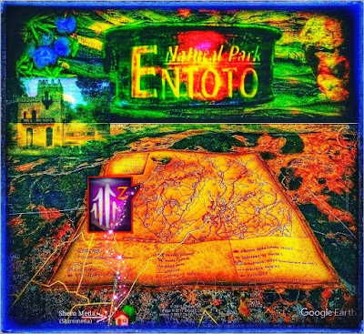
Direction Map to the Alluring Past Entoto's High Plateau with a Historical Giant. Giant stone statues refer to the past Ice Age where man and Giant appear, pulled out of the ancient weathered rocks of aeons. A ncient M egaliths E ntoto N atural P ark's H ighland Geographical Situation A ddis Ababa is situated 9° north of the equator in central Ethiopia. There is a splendid outlook over the sprawling city and five high, solitary mountains from several spots, from the southwest to the southeast (Menagesha, Wachecha, Furi Zukuala and Yerer). Entoto Natural Park's area extends from the northern outskirts of the Capital. Thus, Entoto Natural Park reveals its captivating, grand mountainous landscape at an altitude of 2,600 m, and farther north, the high plateau stretches out towards elevations above 3,000 m. (Håkan Blanck and Pia Englund, Entoto Natural Park 1995) A H ighland T owering O ver t he C apital T he H igh P lateau's M ountain C rest Facing north from...
Entoto Park Main Entrance - Entoto Park (Z) A Modern Park for Nature & People A sincere request prevailed for a family-friendly invitation to the Park's entertaining facilities and cosy amusements, set amidst the Park's exquisite highland Nature. The Park's unique character of highland magnificence would then become within reach for families and passionate nature people. Thus, the somewhat rugged and overwhelming vastness of Entoto Natural Park gave rise to the development of this more comfortable Park, featuring various activities and cultural facilities. Thanks to the welcoming atmosphere, this Park is now a reality, featuring a new family and cultural environment on the Grand Mountain massif. Thus, despite the landscape's high drama, the family offers comfortable adventures with the required modern facilities. This newly inaugurated modern department, Entoto Park, with its dramatic Location on the mountain's southern shoulder, invites visitors through its mai...
Museum and Palace O n the High Plateau Tranquil Surroundings and Dining Options Entoto Maryam (43) and the Museum are located in the former Capital, featuring historic buildings and a Palace, as shown in the image just below. This place is charmingly convenient in every direction, with traditional facilities at the high plateau of this landmark mountain, whose crest rises in venerated dignity, while lovingly adorned through the mist of history as the former Capital, featuring all its must-see gems of the past. This historic site, the former Capital, offers unique architecture and an excellent opportunity for leisurely walks among its historical heritage, featuring a palace, church and a museum. Magnificent, this highland appears in its genuine form, where the peacefully undulating landscape offers the most romantic promenader or delightful hikes out over the high plateau. Here, the passionate Nature trekker can reasonably make close contact with gorgeou...

 • P A Yeomans-Keyli... P A Yeomans-Keyline at Nevallan (4 min) 1956

Comments
Post a Comment